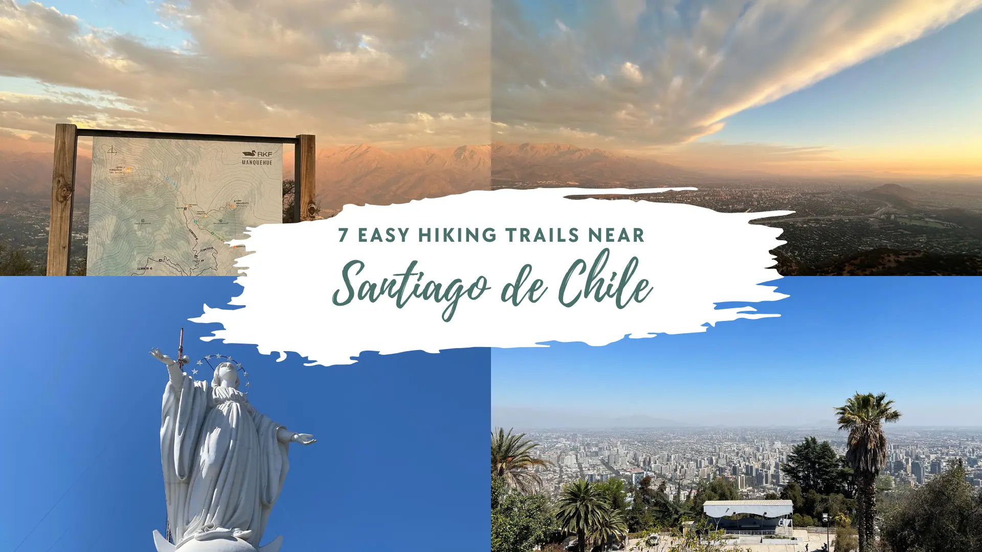
7 Easy Hiking Trails Near Santiago: Beginner-Friendly Adventures in 2025
This article contains affiliate links. If you make a purchase through these links, we may earn a small commission at no extra cost to you. This helps us keep creating free content for you!
Did you know that Santiago is surrounded by over 15 accessible hiking trails within just 2 hours of the city center? Whether you're a complete beginner or someone who hasn't hit the trails in years, Chile's capital offers some of the most rewarding easy hikes in South America. We've personally explored dozens of trails around Santiago, and let me tell you – you don't need to be an experienced mountaineer to experience the breathtaking Andean landscapes!
From gentle forest walks to scenic viewpoints that'll make your Instagram followers jealous, these easy hiking trails near Santiago prove that adventure doesn't have to be intimidating. Ready to lace up those hiking boots and discover why Santiago is quickly becoming South America's hiking capital?
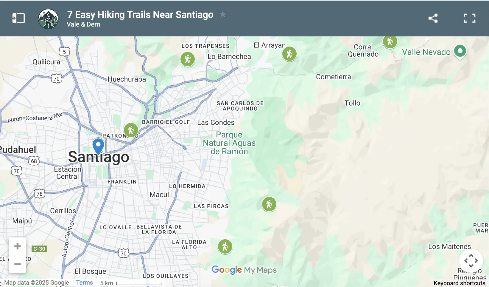
Click to load our interactive map
Click to explore our interactive map of 7 easy hiking trails near Santiago showing all trail locations.
Interactive map of 7 easy hiking trails near Santiago showing trail locations.
This guide covers the 7 best easy hiking trails near Santiago that are perfect for beginners, families, and anyone looking to experience Chile's natural beauty without extreme physical demands. Each trail includes detailed directions, difficulty ratings, what to expect, and insider tips to make your hiking adventure safe and memorable.
If you're planning a longer stay, don't miss our complete 1-week Santiago itinerary for more adventure ideas around the city. For the best hiking experience, consider staying in central Santiago where you'll have easy access to metro stations and trail departure points - find great hotel deals here.
🏔️ Why Santiago is Perfect for Beginner Hikers
Santiago isn't just Chile's capital – it's a gateway to some of the most accessible hiking in South America. Here's what makes it ideal for beginners:
🌞 Year-Round Hiking Weather
Over 300 sunny days annually with minimal rainfall. Santiago's Mediterranean climate means you can hike comfortably in almost any season.
🚇 Excellent Public Transportation
Most trailheads are accessible by Santiago's efficient metro and bus system. No need for expensive tours or rental cars.
⏱️ Flexible Trail Options
Trails ranging from 1 hour to 4 hours accommodate all fitness levels and time constraints.
🛤️ Well-Maintained Paths
Clear signage, regular maintenance, and minimal technical difficulty make these trails safe for beginners.
- Stunning Andean mountain views without extreme elevation gains
- Active hiking community and plenty of guided tour options
- Diverse landscapes from urban parks to mountain wilderness
- Safe environment with regular foot traffic and emergency services access
- Cost-effective adventure with free trails and affordable transportation
🎯 What Makes a Trail "Easy" - Our Rating System
Not all "easy" trails are created equal. Here's our criteria for beginner-friendly hiking near Santiago:
Easy Trail Requirements:
- Distance: Under 10 kilometers (6.2 miles) round trip
- Elevation gain: Less than 500 meters (1,640 feet)
- Trail surface: Well-maintained paths with clear markings
- Time commitment: 2-5 hours including breaks and photo stops
- Accessibility: Reachable by public transport or short drive
- Safety factors: Clear signage and regular foot traffic
Each trail in this guide meets these criteria, but some are easier than others. We'll highlight the absolute beginner trails versus those that might challenge you a bit more while still remaining accessible.
Top-Rated Activities in Santiago
🥾 Top 7 Easy Hiking Trails Near Santiago
Here are the 7 best easy hiking trails near Santiago that are perfect for beginners, families, and anyone looking to experience Chile's natural beauty without extreme physical demands. Each trail includes detailed directions, difficulty ratings, what to expect, and insider tips to make your hiking adventure safe and memorable.
| Trail | Distance | Elevation Gain | Time | Difficulty | Getting There |
|---|---|---|---|---|---|
| Cerro San Cristóbal | 9 km (5.6 mi) | 240m (784 ft) | 2.5 hours | ⭐⭐☆☆☆ Easy | Metro Line 1 to Baquedano |
| Cerro Manquehuito | 3.5 km (2.2 mi) | 220m (722 ft) | 1.5-2 hours | ⭐⭐☆☆☆ Easy | Metro Line 1 to Escuela Militar + bus |
| Quebrada de Macul | 8.7 km (5.4 mi) | 480m (1,575 ft) | 3.5 hours | ⭐⭐⭐☆☆ Moderate | Metro Line 4 to Quilín + bus |
| Aguas de Ramón (Short) | 3-6 km (2-4 mi) | 150-300m | 2-3 hours | ⭐⭐☆☆☆ Easy | Metro Line 4 to Plaza Egaña + bus D15 |
| Bosque El Panul | 3-5 km (2-3 mi) | 100-200m | 1-2 hours | ⭐☆☆☆☆ Very Easy | Metro Line 5 to Bellavista La Florida + bus |
| Cerro Pochoco | 5 km (3.1 mi) | 780m (2,559 ft) | 3-4 hours | ⭐⭐⭐☆☆ Moderate | Metro Line 1 to Manquehue + taxi |
| Yerba Loca (Easy) | 2-6 km (1-4 mi) | 100-200m | 1-3 hours | ⭐⭐☆☆☆ Easy | Metro Line 1 to Manquehue + shuttle |
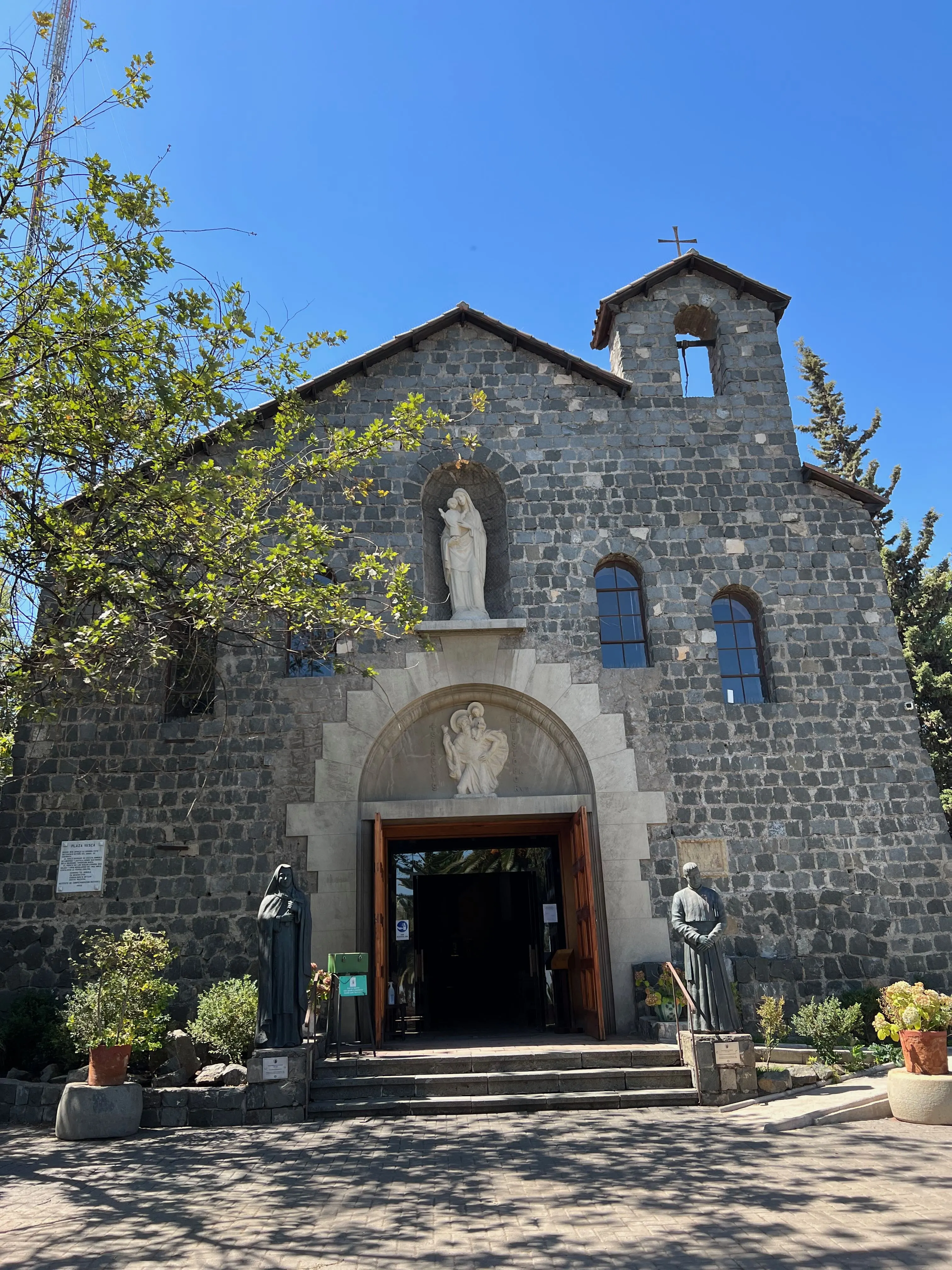
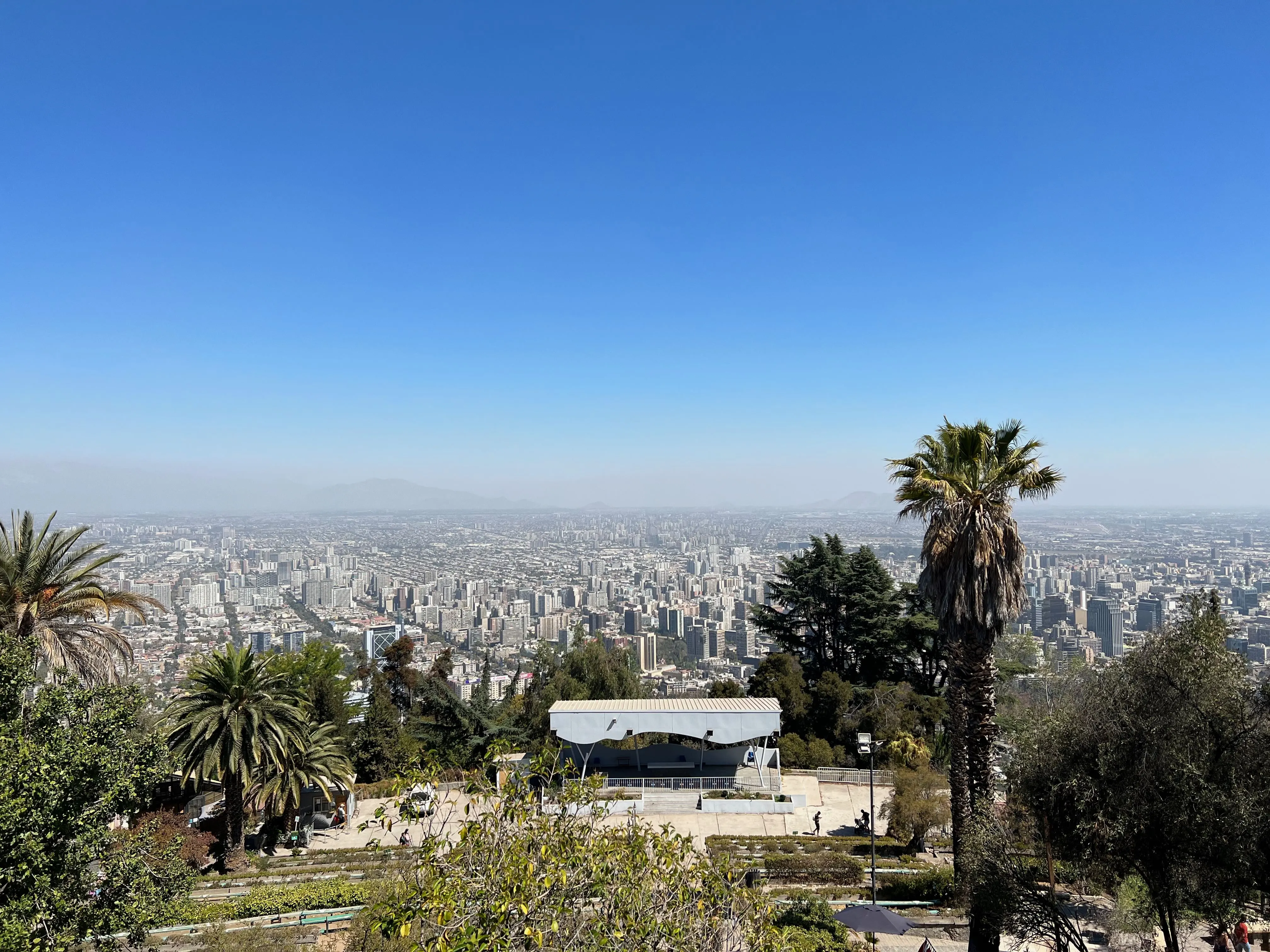
🏔️ Cerro San Cristóbal Trail
Cerro San Cristóbal is Santiago's most iconic urban hiking destination and the perfect introduction to hiking near the city. This historic hill offers panoramic 360-degree views of Santiago with the majestic Andes as your backdrop, plus the chance to visit the famous 22-meter Virgin Mary statue that watches over the capital.
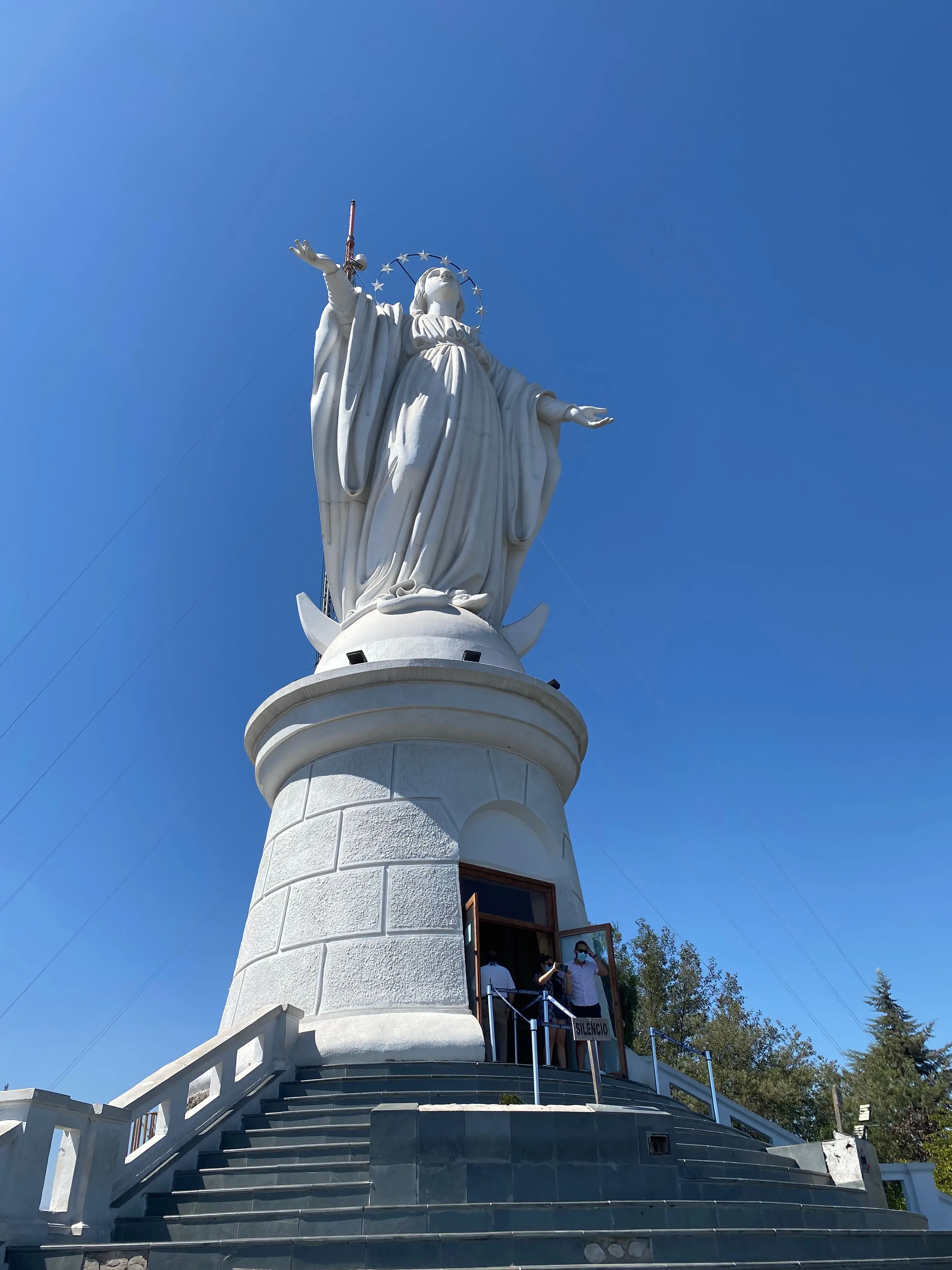
Panoramic city views from Cerro San Cristóbal with the iconic 22-meter Virgin Mary statue
📊 Trail Stats
- Distance: 9 km (5.6 miles) round trip
- Elevation gain: 240 meters (784 feet)
- Hiking time: 2.5 hours round trip
- Difficulty: ⭐⭐☆☆☆ Easy
- Best features: 360° city views, Virgin Mary statue, historic funicular
- Getting there: Metro Line 1 to Baquedano station
🚶♂️ The Experience
Start your hike from the Pío Nono entrance in Bellavista, just a 5-minute walk from Metro Baquedano. The trail is mostly a paved road or wide path, making it perfect for beginners and families. As you climb, you'll pass through beautiful gardens and several viewpoints offering increasingly spectacular vistas.
The summit at 880 meters rewards you with stunning 360-degree views of Santiago. On clear days, you can see the towering snow-capped peaks of El Plomo and other 5,000+ meter giants in the distance. The late afternoon light creates magical pink and purple hues across the city as the sun sets behind the coastal range.
💡 Insider Tips
- Take the historic funicular up and walk down for a different perspective
- Visit during sunset for the most spectacular views and photos
- The cable car (teleférico) from Pedro de Valdivia offers another scenic option
- Stop at the summit café for refreshments with a view
- Early morning visits offer clearer air and fewer crowds
📍 AllTrails Link: Cerro San Cristóbal – San Cristóbal Hill Trail (out & back, 5.6 mi / 9 km, 784 ft gain, ~2.5 h)
🌸 Cerro Manquehuito Trail
Cerro Manquehuito, affectionately called the "little brother" of Cerro Manquehue, offers phenomenal views over Santiago without the extreme difficulty of its bigger sibling. This popular trail is perfect for beginners looking to experience a real mountain summit while building hiking confidence.
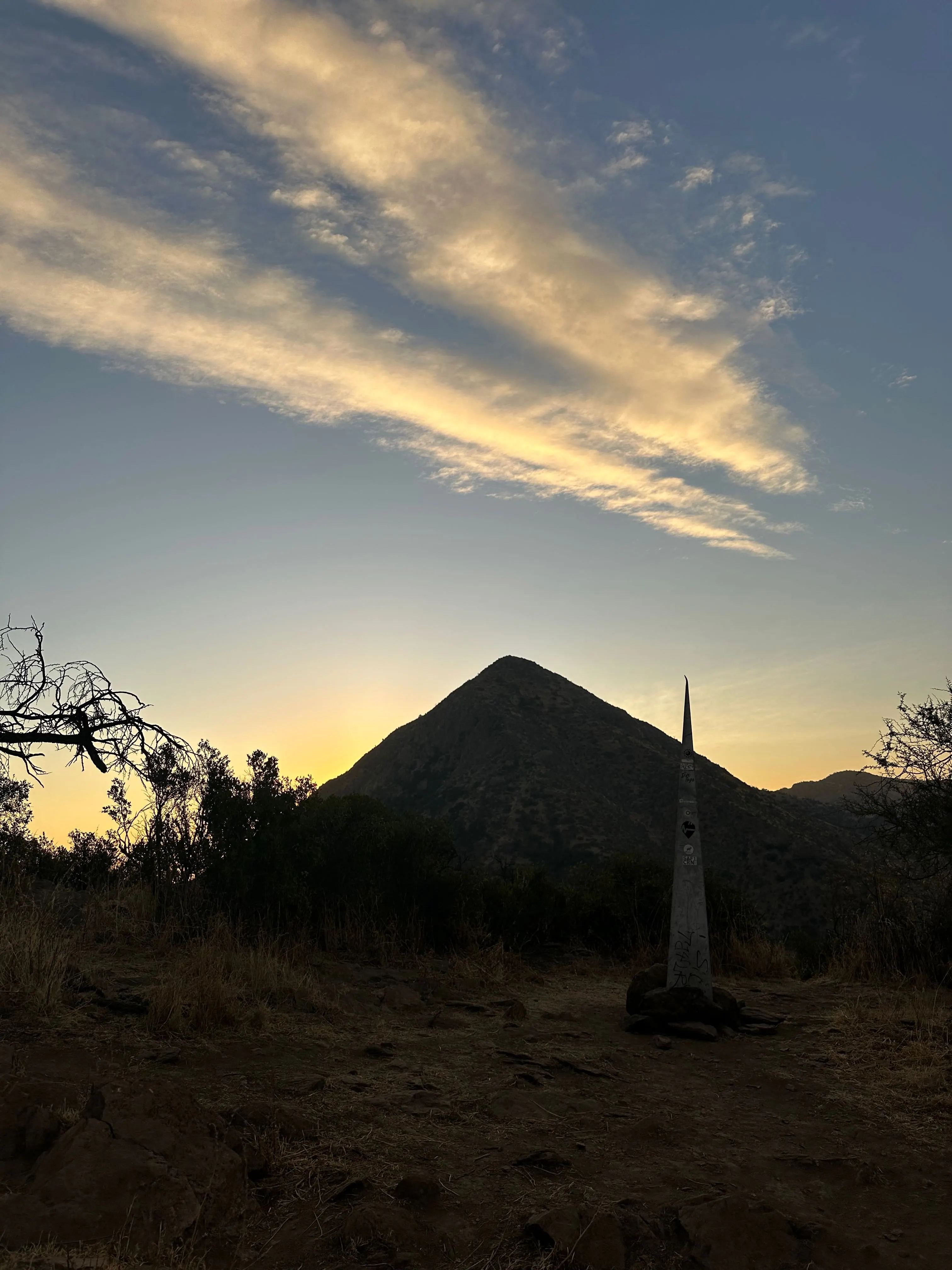
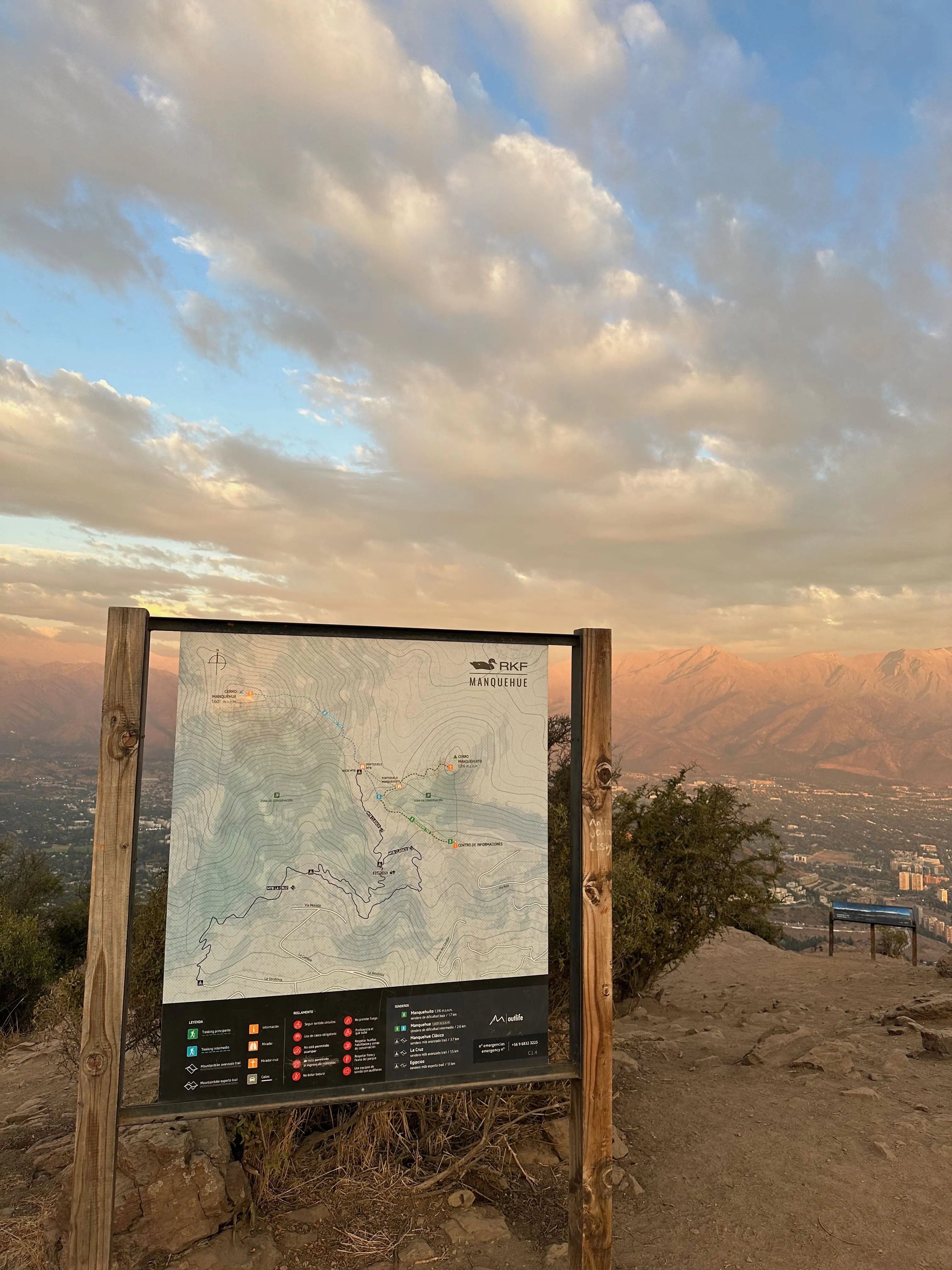
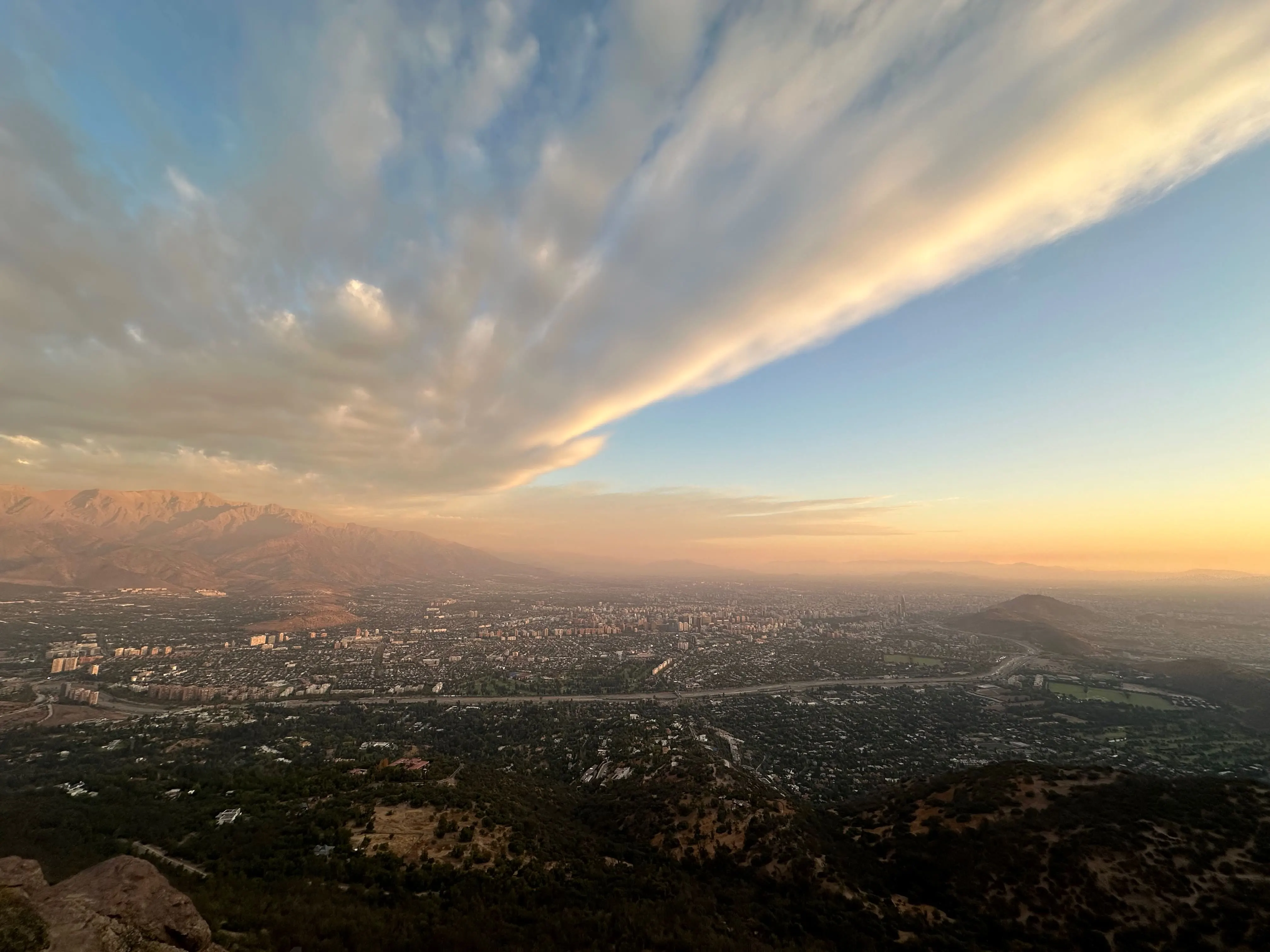
Stunning panoramic views of Santiago and the Andes from Cerro Manquehuito summit
📊 Trail Stats
- Distance: 3.5 km (2.2 miles) round trip
- Elevation gain: 220 meters (722 feet)
- Hiking time: 1.5-2 hours round trip
- Difficulty: ⭐⭐☆☆☆ Easy
- Best features: Phenomenal Santiago views, great first summit
- Getting there: Metro Line 1 to Escuela Militar + bus C14
🚶♂️ The Experience
The trail begins in the upscale Vitacura/Lo Curro area and winds through native scrubland typical of central Chile's Mediterranean climate. While the path is dirt and can get steep and slippery near the top (good shoes are essential), the effort is absolutely rewarded with some of the best views in Santiago.
From the summit, you'll have an incredible vantage point over all of Santiago with the Andes mountains forming a dramatic backdrop. On clear days, you can spot major peaks like El Plomo and La Paloma. This hike is especially popular with families and serves as an excellent "first summit" for newcomers to Chilean mountain hiking.
💡 Insider Tips
- Take the colectivo (shared taxi) from Metro Escuela Militar for easier access
- Don't be deterred by "Privado" signs - the public trail is at the end of Via Roja
- Bring good grip shoes as the final section can be slippery
- Perfect for sunrise or sunset photography
- Parking is limited, so public transport or taxi is recommended
📍 AllTrails Link: Cerro Manquehuito Trail (out & back, ~2.0 mi / 3.2 km, ~720 ft gain, ~1.5 h)
💧 Quebrada de Macul (Salto de Macul)
Quebrada de Macul Natural Park is a local favorite that combines forest hiking with the reward of a beautiful 10-meter waterfall. This beginner-friendly trail takes you through native sclerophyllous forest and offers a refreshing escape from Santiago's urban environment, with the added bonus of being completely free to access.
📊 Trail Stats
- Distance: 8.7 km (5.4 miles) round trip
- Elevation gain: 480 meters (1,575 feet)
- Hiking time: 3.5 hours round trip
- Difficulty: ⭐⭐⭐☆☆ Moderate
- Best features: Native forest, 10m waterfall, panoramic "U" viewpoint
- Getting there: Metro Line 4 to Quilín + bus to end + walk
🚶♂️ The Experience
This well-marked trail starts with a gentle walk through Chile's characteristic sclerophyllous forest, featuring native trees that have adapted perfectly to the region's hot summers and wet winters. Along the way, you'll reach the popular "U" viewpoint offering nice vistas of the surrounding hills and Santiago's outskirts.
The highlight is reaching the Salto de Macul, where a 10-meter waterfall drops into a refreshing pool. This is the perfect turn-around point for most hikers, though more adventurous souls can continue beyond the falls to tackle the steep trek up Cerro La Cruz or Cerro Ramón. The forest setting provides a cool microclimate that's especially welcome on hot summer days.
💡 Insider Tips
- Start early in summer as it can get hot with limited shade in the canyon
- Bring extra water and sun protection for the exposed sections
- The waterfall is most impressive after winter rains (July-September)
- Free entry makes this one of the most budget-friendly hikes near Santiago
- Take the 1.5km walk from the bus stop as a warm-up to the main trail
📍 AllTrails Link: Cascada San Juan via Sendero Estero Ex Quincho (out & back, ~8.7 km, moderate, waterfall at the end)
🌲 Aguas de Ramón Park (Easy Trails)
Parque Natural Aguas de Ramón is a large nature reserve that offers something for every skill level. While the park is famous for the challenging 17km trek to Salto de Apoquindo waterfall, beginners can enjoy shorter, easier trails like the Canto del Agua and Paleontological Loop, which provide a perfect introduction to Andean hiking.
📊 Trail Stats (Easy Options)
- Canto del Agua: 2 km (1.2 mi), 1 hour, very easy
- Paleontological Loop: 3 km (1.9 mi), 1.5 hours, easy
- Los Peumos Trail: 6 km (3.7 mi), 3 hours, moderate
- Difficulty: ⭐⭐☆☆☆ Easy to Moderate
- Best features: Native forest, creek views, educational signs
- Getting there: Metro Line 4 to Plaza Egaña + bus D15
🚶♂️ The Experience
The shorter trails at Aguas de Ramón wind through native woodlands along the Ramón creek, offering a peaceful escape into nature just minutes from Santiago. The Canto del Agua trail is perfect for families and first-time hikers, while the Paleontological Loop adds educational value with fossil interpretations and geological features.
These easier trails give you a taste of the park's beautiful ecosystem without the commitment of the full-day waterfall hike. You'll experience the same native vegetation and creek-side environments while building confidence for future longer adventures. The park has excellent facilities including restrooms, water fountains, and a ranger station.
💡 Insider Tips
- Small entrance fee (around CLP 3,000) supports park conservation
- Arrive early - park has seasonal hours and morning entry limits
- Use shorter trails to prepare for the full Salto de Apoquindo trek later
- Colectivos from Plaza La Reina make access easier than walking
- Check park website for winter closures after heavy rains
📍 AllTrails Link: Parque Natural Aguas de Ramón (multiple trail options from easy to challenging)
🌳 Bosque El Panul Nature Walk
Bosque El Panul is Santiago's last remaining fragment of native sclerophyllous forest within the city basin - a rare green gem that offers the easiest and most accessible nature experience on our list. This community-protected forest is perfect for gentle walks among century-old trees and wildlife watching without any significant elevation gain.
📊 Trail Stats
- Distance: 3-5 km (2-3 miles) - customizable routes
- Elevation gain: 100-200 meters (minor undulations)
- Hiking time: 1-2 hours (very flexible)
- Difficulty: ⭐☆☆☆☆ Very Easy
- Best features: Native forest, wildlife watching, community conservation
- Getting there: Metro Line 5 to Bellavista La Florida + bus E07 or 322
🦉 The Experience
Walking through El Panul feels like stepping back in time to see what Santiago's landscape looked like before urban development. The forest features native trees like espino, quillay, and litre that have adapted perfectly to central Chile's Mediterranean climate. Multiple dirt paths wind through the forest with no single "destination" - the journey itself is the reward.
Wildlife enthusiasts will love the bird watching opportunities: look for pequén owls, loicas, Chilean eagles, and various hummingbird species. The forest is also home to foxes and rabbits. One popular route leads to the Mirador de la Cruz viewpoint, but feel free to explore the network of trails at your own pace.
💡 Insider Tips
- Perfect for meditation, photography, or peaceful nature walks
- Bring binoculars for the excellent bird watching opportunities
- No formal facilities - come prepared with water and carry out all trash
- Best visited during daylight hours for safety
- Free access as this is community-managed protected land
- Ideal for families with young children who need gentle terrain
📍 AllTrails Link: Parque Comunitario Bosque de Panul (multiple trail options, easy nature walks)
⛰️ Cerro Pochoco Trail
Cerro Pochoco offers the best views-to-effort ratio of any hike near Santiago. While it's one of the more challenging trails on our "easy" list, this local training favorite rewards hikers with spectacular panoramic views of the city and distant Andean peaks like El Plomo, La Paloma, and El Altar rising above 5,000 meters.
📊 Trail Stats
- Distance: 5 km (3.1 miles) round trip
- Elevation gain: 780 meters (2,559 feet)
- Hiking time: 3-4 hours round trip
- Difficulty: ⭐⭐⭐☆☆ Moderate
- Best features: 360° views, 5,000m+ Andean peaks, training trail
- Getting there: Metro Line 1 to Manquehue + bus C01 + taxi to trailhead
🚶♂️ The Experience
Starting from the Arrayán area in Lo Barnechea, this trail heads straight up a ridge with no messing around - you'll be going up most of the 2.5km to the summit. The path is well-marked but rocky with loose gravel in sections, making trekking poles and good boots helpful for confidence on the descent.
From Pochoco's 1,804-meter summit, you'll enjoy one of the most spectacular viewpoints near Santiago. Turn around to see the urban sprawl below, then gaze at the horizon where massive snow-capped peaks dominate the skyline. Sunrise and sunset from this summit are truly unforgettable experiences, though even a midday hike rewards you with fantastic photo opportunities.
💡 Insider Tips
- This is a step up from easier trails - save it for when you've built some confidence
- Start early in summer to avoid afternoon heat (limited shade)
- Consider trekking poles for the rocky, steep sections
- Arrange taxi pickup at Plaza San Enrique to avoid long bus waits
- Avoid after heavy rains as the trail becomes very slippery
- No entrance fee, but bring cash for taxi access
📍 AllTrails Link: Cerro Pochoco Trail (out & back, ~5 km, ~780 m gain, 3-4 h, moderate)
🏔️ Yerba Loca Natural Sanctuary (Easy Routes)
Yerba Loca is a vast mountain park that offers flexible hiking options from gentle valley walks to challenging glacier treks. For beginners, the Villa Paulina area provides easy access to high-altitude Andean scenery with well-maintained trails, picnic facilities, and the chance to experience mountain landscapes without extreme effort.
📊 Trail Stats (Easy Options)
- Villa Paulina walks: 2-6 km, 1-3 hours, easy
- Elevation gain: Minimal in valley (100-200m for viewpoints)
- Difficulty: ⭐⭐☆☆☆ Easy
- Best features: Alpine scenery, condors, mountain streams
- Advanced option: Glaciar La Paloma (28km, 2 days, expert level)
- Getting there: Metro Line 1 to Manquehue + shuttle to Villa Paulina
🦅 The Experience
Located at Km 15 of the Farellones road, Villa Paulina (1,500m elevation) serves as a base camp with picnic sites, café, and the starting point for various trails. Easy walks take you through changing ecosystems - from cactus-dotted slopes to alpine meadows with streams where condors often soar overhead.
The gentle paths around Villa Paulina offer incredible high-mountain scenery without serious elevation gain. Popular short hikes include the Mirador del Águila viewpoint and stream-side walks where you can experience pristine Andean nature. Even if you just spend a few hours here, you'll get a taste of Chile's incredible high-altitude landscapes.
💡 Insider Tips
- Best visited October-May for green landscapes and clear trails
- Winter visits possible but expect snow and icy conditions
- Small entrance fee (~CLP 7,000) helps maintain this protected area
- Use the easy trails to prepare for the advanced La Paloma glacier trek
- Shared shuttles from Plaza San Enrique make access affordable
- Always check park conditions before visiting, especially in winter
📍 AllTrails Link: Yerba Loca Nature Sanctuary (multiple trail options from easy walks to challenging glacier treks)
🎒 Essential Gear for Easy Hiking Near Santiago
One of the best things about easy hiking near Santiago is that you don't need expensive or specialized gear. Here's what you should bring for a safe and comfortable hiking experience:
👟 Footwear & Clothing
- Comfortable hiking shoes with good grip (trail runners work fine)
- Moisture-wicking socks to prevent blisters
- Lightweight, breathable layers you can add or remove
- Weather-appropriate clothing for season and conditions
☀️ Sun Protection
- Wide-brimmed hat or cap with good coverage
- Sunglasses with UV protection
- SPF 30+ sunscreen (Chilean sun is intense at altitude)
- Lip balm with SPF for high-altitude protection
🥤 Hydration & Nutrition
- Water bottle - minimum 1 liter per person
- Light snacks - energy bars, fruit, or trail mix
- Electrolyte tablets for longer hikes
- Lunch or substantial snack for 3+ hour hikes
🚨 Safety & Navigation
- Basic first aid kit with band-aids and pain relievers
- Emergency whistle for signaling help
- Fully charged phone with offline maps downloaded
- Lightweight backpack (20-30 liter capacity)
💡 Gear Tips for Santiago Hiking
- You don't need hiking boots - good sneakers or trail runners work fine for these trails in most cases
- Layers are key - Santiago's weather can change quickly, especially in the mountains
- Bring more water than you think you need - the high altitude and dry climate cause faster dehydration
- A small daypack is perfect - you don't need a huge backpack for day hikes
- Consider trekking poles for trails with steep sections like Cerro Pochoco
Remember, these are easy trails, so don't overthink the gear. The most important items are water, sun protection, and comfortable shoes. You can always upgrade your gear as you progress to more challenging hikes!
🌞 Best Times to Hike Near Santiago
Santiago's Mediterranean climate and high altitude create unique hiking conditions throughout the year. Here's when to hit the trails for the best experience:
🍂 Optimal Months: March-May & September-November
- Perfect temperatures - 15-25°C (59-77°F)
- Clear mountain views with minimal haze
- Comfortable hiking without extreme heat or cold
- Spring wildflowers bloom in September-November
- Autumn colors in deciduous areas during March-May
☀️ Summer (December-February)
- Start early - begin hikes before 8 AM
- Hot afternoons - temperatures can reach 35°C (95°F)
- Longer daylight hours for extended adventures
- Dry conditions with minimal rain
- Crowded trails - popular vacation time
❄️ Winter (June-August)
- Shorter days - plan 4-5 hour hiking window
- Crisp, clear air with excellent mountain visibility
- Snow-capped peaks create spectacular backdrops
- Fewer crowds on trails
- Occasional rain - check weather forecasts
⏰ Best Time of Day
- Early morning (7-9 AM) - cool temperatures, fewer crowds
- Late afternoon (4-6 PM) - golden hour lighting
- Avoid midday (11 AM-2 PM) - intense sun and heat
- Weekdays vs weekends - significantly less crowded
🌦️ Weather Patterns to Know
- Santiago sits at 1,640 feet elevation - expect cooler temperatures than sea level
- Mountain weather changes quickly - always check forecasts before heading out
- Wind patterns - afternoons can be windy, especially on exposed trails like Cerro Pochoco
- Precipitation is rare but possible - most rain falls May-September
- UV exposure is intense - high altitude means stronger sun even on cloudy days
Pro tip: If you're visiting during summer, consider the shaded forest walks at Bosque El Panul or the cooler microclimate of Quebrada de Macul. For winter hiking, the shorter Cerro Manquehuito trail is perfect for maximizing daylight hours.
🚨 Safety Tips for Beginner Hikers
While these trails are considered easy, safety should always be your top priority. Here are essential safety tips for hiking near Santiago:
🚨 Before You Go
- Tell someone your plans - share your route and expected return time
- Check weather forecasts - mountain weather can change quickly
- Download offline maps - cell service can be spotty
- Research trail conditions - check for closures or hazards
- Start early - allow extra time for unexpected delays
🥾 On the Trail
- Stay on marked trails - don't take shortcuts or unmarked paths
- Hike with a buddy - especially for your first few adventures
- Carry emergency supplies - whistle, first aid, extra water
- Know your limits - turn back if you're uncomfortable
- Take breaks - pace yourself and stay hydrated
📱 Emergency Preparedness
- Fully charged phone - bring portable charger for longer hikes
- Know emergency numbers - Chilean emergency: 133
- Carry emergency whistle - three sharp blasts signal distress
- Basic first aid knowledge - know how to treat common injuries
- Travel insurance - ensure you're covered for outdoor activities
🏔️ Altitude Awareness
- Santiago sits at 1,640 feet - higher than many visitors expect
- Hydrate extra - high altitude causes faster dehydration
- Take it slow - allow time to acclimatize if coming from sea level
- Watch for altitude symptoms - headaches, nausea, dizziness
- Sun protection is crucial - UV exposure increases with elevation
🛡️ Don't Forget Travel Insurance
We never travel without insurance. Heymondo covers medical expenses, trip cancellation, and stolen or damaged electronics, with 24/7 assistance through their app. As one of our readers, you get 5% off your policy.
Get 5% off your travel insurance →If you purchase through our link, we may earn a commission at no extra cost to you. Discount not available for US residents.
🗣️ Basic Spanish Phrases for Hikers
While many Chileans speak some English, knowing basic Spanish phrases can be helpful:
- "¿Dónde está el sendero?" - Where is the trail?
- "Necesito ayuda" - I need help
- "¿Hay agua cerca?" - Is there water nearby?
- "¿Cuánto falta para llegar?" - How much further to go?
- "Gracias por su ayuda" - Thank you for your help
Remember: these easy trails are generally very safe, but preparation and caution will ensure your hiking experience is both enjoyable and secure.
🚇 Transportation and Access Guide
One of the best things about hiking near Santiago is how accessible these trails are using public transportation. Here's your complete guide to reaching each trailhead:
| Trail | Metro Line | Final Transport | Total Cost (USD) | Travel Time |
|---|---|---|---|---|
| Cerro San Cristóbal | Line 1 to Baquedano | Walk 5 minutes | $1.50 | 30-45 minutes |
| Cerro Manquehuito | Line 1 to Escuela Militar | Bus C14 + walk | $2.50 | 60-75 minutes |
| Quebrada de Macul | Line 4 to Quilín | Bus to end + walk | $2.50 | 60-75 minutes |
| Aguas de Ramón | Line 4 to Plaza Egaña | Bus D15 | $2.50 | 60-75 minutes |
| Bosque El Panul | Line 5 to Bellavista La Florida | Bus E07 or 322 | $2.50 | 60-75 minutes |
| Cerro Pochoco | Line 1 to Manquehue | Bus C01 + taxi | $15-20 | 75-90 minutes |
| Yerba Loca | Line 1 to Manquehue | Bus C01 + shuttle | $12-15 | 90-120 minutes |
🚇 Metro System Tips
- Get a Bip! card - reloadable card works on metro and buses
- Peak hours to avoid - 7-9 AM and 6-8 PM weekdays
- Weekend schedules - reduced frequency but still reliable
- Metro opens at 6 AM - perfect for early morning hikes - it closes at 10 PM
- Safe and clean - Santiago's metro is considered one of the best in Latin America
🚌 Bus Connections
- Transantiago system - integrated with metro using same Bip! card
- GPS tracking - use RED Bus app to track real-time arrivals
- Bus stops - look for red and white Transantiago signs
- Frequency - buses run every 10-15 minutes during peak hours
- Ask for help - drivers and passengers are generally helpful
🚗 Alternative Transport Options
- Uber/Taxi - convenient for early morning starts or groups
- Rental car - gives flexibility for multiple trails in one day and access to remote locations
- Guided tours - many include transportation from Santiago hotels
- Colectivos - shared taxis common for final stretches to trailheads
Pro tip: Download the RED Bus app and Metro de Santiago app for real-time public transport information. Both are available in English and make navigation much easier!
❓ Frequently Asked Questions
What makes a hiking trail 'easy' near Santiago?
Easy trails near Santiago are under 10 kilometers round trip, have less than 500 meters elevation gain, feature well-maintained paths, and are accessible by public transport. Most take 2-5 hours including breaks and offer clear signage with regular foot traffic for safety.
Can I reach Santiago hiking trails by public transportation?
Yes! Most easy hiking trails near Santiago are accessible by metro and bus. For example, Cerro San Cristóbal is accessible via Metro Line 1 to Baquedano, while Quebrada de Macul connects via Metro Line 4 to Quilín then bus. Some trails like Cerro Pochoco may require a short taxi ride for the final stretch.
What gear do I need for easy hikes near Santiago?
For easy Santiago hikes you need comfortable hiking shoes, sun protection (hat, sunglasses, SPF 30+ sunscreen), minimum 1 liter water per person, light snacks, basic first aid kit, and a 20-30 liter backpack. Weather-appropriate layers are essential as temperatures vary with elevation.
When is the best time to hike near Santiago?
The optimal months are March-May and September-November for mild temperatures and clear skies. Summer (December-February) requires early morning starts to avoid heat, while winter (June-August) offers shorter days but clearer mountain views. Early morning (7-9 AM) provides the best conditions.
Are Santiago hiking trails safe for beginners?
Yes, the easy trails near Santiago are very safe for beginners. They feature well-marked paths, regular foot traffic, clear signage, and minimal technical difficulty. Always inform someone of your plans, carry emergency supplies, stay on marked trails, and consider hiking with a buddy for your first adventures.
How much does it cost to hike near Santiago?
Most hiking trails near Santiago are completely free. Transportation costs vary: metro/bus rides cost $1-3 USD, while taxi/Uber to more remote trailheads costs $10-25 USD. Some nature sanctuaries may charge small entrance fees ($2-5 USD). The main costs are transportation and optional gear.
🥾 Start Your Santiago Hiking Adventure Today!
These 7 easy hiking trails near Santiago prove that you don't need to be an experienced mountaineer to experience Chile's incredible natural beauty! From the urban icon of Cerro San Cristóbal to the hidden forest gem of Bosque El Panul, each trail offers unique rewards without overwhelming challenges.
Start with gentler options like Bosque El Panul or Cerro Manquehuito, then work your way up to more challenging adventures like Cerro Pochoco as your confidence grows. Remember – every expert hiker started exactly where you are today. Santiago's incredible trail network is waiting for you, and with excellent public transportation access, there's no excuse not to explore!
Once you've mastered these beginner trails, you might want to challenge yourself with more advanced hiking. For a truly spectacular guided experience, I highly recommend the Cajón del Maipo and Volcán San José Hike - an 8km trek that takes you through stunning Andean landscapes with professional guides. Check out our best hikes in El Chaltén guide for inspiration on what's possible as you build your hiking skills and confidence.
🎯 Your Next Steps
- Choose your first trail - Cerro San Cristóbal or Bosque El Panul are perfect for beginners
- Check the weather - plan for Santiago's changing mountain conditions
- Pack the essentials - water, sun protection, and comfortable shoes
- Download offline maps - cell service can be spotty on some trails
- Tell someone your plans - safety first, even on easy trails
- Start early - beat the crowds and enjoy cooler temperatures
Ready to explore? Pick your first trail and start planning your Chilean hiking adventure today! Santiago's mountains are calling, and these easy trails are the perfect way to answer that call.
For more Santiago adventures, don't miss our complete 1-week Santiago itinerary for urban exploration ideas.
¡Buen viaje! (Have a great trip!)